
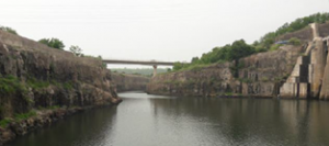
Planys conducted bathymetry survey at Tail Race channel (TRC) of a large dam in Central India to assess the quantity of debris or loose muck in the entire Tail Pool and the TRC. A large deposition of boulders and stones was a cause of concern as it was decreasing the overall water head available to the turbines thus leading to reduced power generation. This survey helped in identifying the presence and quantity of such debris for the client to suitably plan for removal. The TRC was located at a higher altitude than the river and thus traditional bathymetry was not possible.
Scope of Work: Bathymetry survey of a 850m long Tail Race Channel to assess quantity of bounders deposited that lead to lower power generation efficiency. Overall volume of the boulders and the debris was calculated by this survey.
Planys Solution: The inspection was performed using Planys’ ROV Beluga equipped with high resolution camera, GPS, side-scan SONAR, altimeter and depth sensor.
- ROV Beluga with a GPS above water and SONAR below water collected the relevant data in a 5x5m grid during the period when the turbines were shutdown
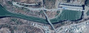
- The data was then filtered, cleaned and computed in the form of a 3D representation for the client. This was then subtracted from the as-built-topology of the TRC and the volumetric difference was computed to be to the tune of 30,000 cubic metre.
- The 3D bathymetry representation was then displayed and geo-tagged on the Planys Analytics Dashboard (PAD) with localised click-to-view video feature.
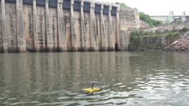
Images show deployment and grid-wise coverage of area by ROV system during survey
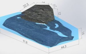
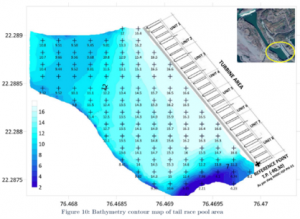
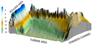
Images show 3D chart of debris, 2D & 3D contour map of the data collected from the bathymetry survey of the TRC